
We prepare Bushfire Management Plans led by our Level 2 practitioner who is highly experienced in all subdivisional work from 2 lot to 20,000 lot developments.
Feel free to contact us for a discussion on what you might need. We know the constantly changing regulations and requirements can sometimes be challenging to understand and we are more than happy to help you get your head around them.
A BMP describes bushfire risks and the factors contributing to them, and various techniques for mitigating the identified risks. Implementation and compliance schedules identify those parties responsible for implementing the control measures as well as those responsible for auditing the actions.
Vegetation classification
Vegetation assessment and classification including slope analysis as per AS3959. Vegetation needs to be classified as its probable mature status. Vegetation classification for BHL assessments (35 classes) is more detailed than that required for BAL contours (8 classes). This analysis needs to incorporate building envelopes and clearing restrictions as required.

Bushfire Hazard Level Assessment
BHL assessments are normally undertaken earlier in the planning cycle before lot layouts and suburb design have been finalised. This assessment identifies regional-scale bushfire risks and potential strategies to be considered during the process of land rezoning.

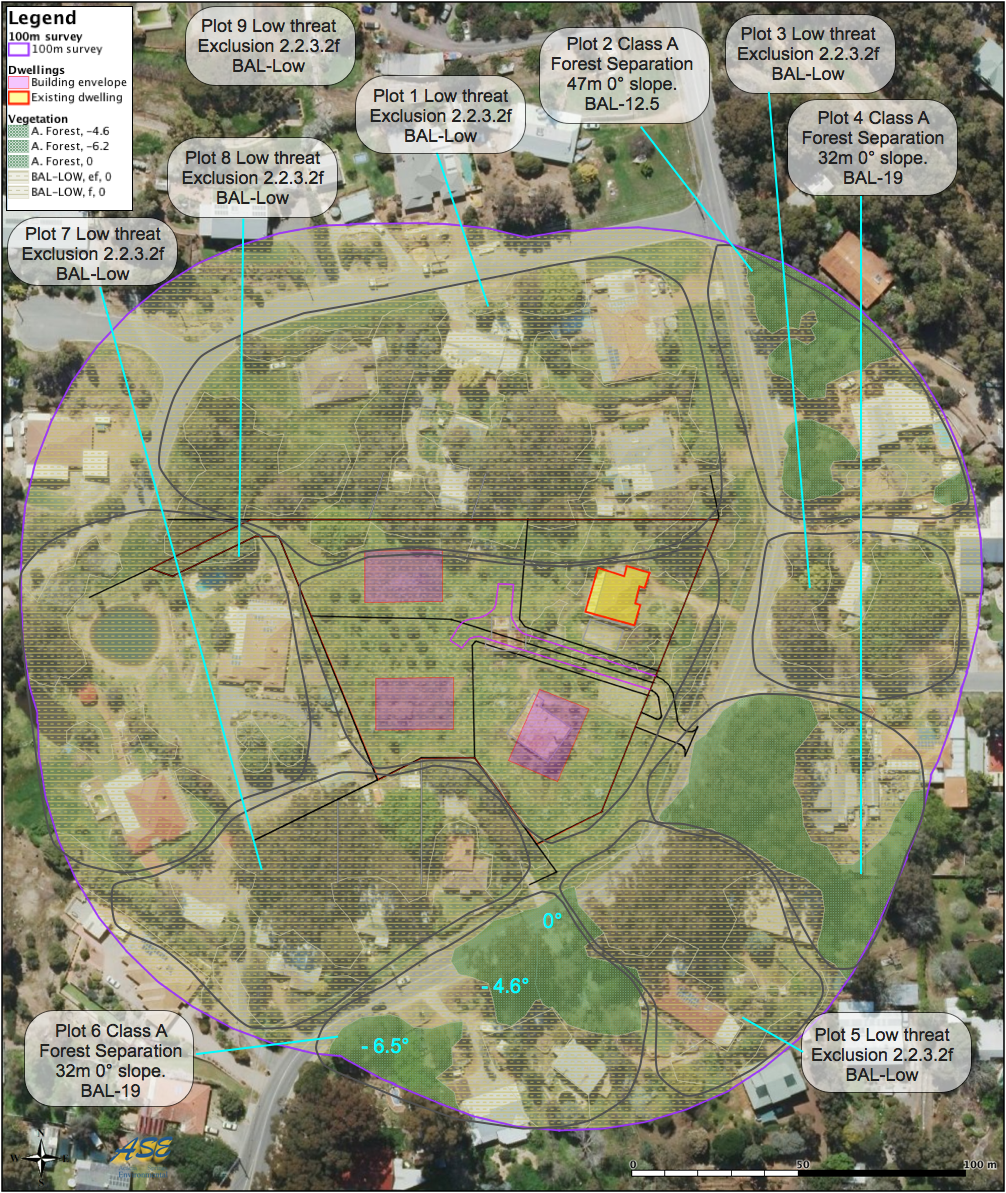
BAL Contours
BAL contours are normally prepared for areas already zoned for residential development eg. traditional small-lot urban development or certain special rural zones. BAL contours identify site-specific bushfire risks and the separation distances between vegetation plots and any proposed habitable buildings.