

Bushfire Attack Level (BAL) Assessments
Do you need a BAL assessment or Simplified Bushfire Management Plan (BMP) for your Development Application (DA) or Building Approval? We provide quotes and preliminary advice at no cost to you.
We have an experienced, BPAD-accredited and friendly team throughout the southwest of WA who specialise in these. We can help save you stress and hassle, because we understand the regulations.
Ready to discuss or obtain a free quote?
BAL ratings
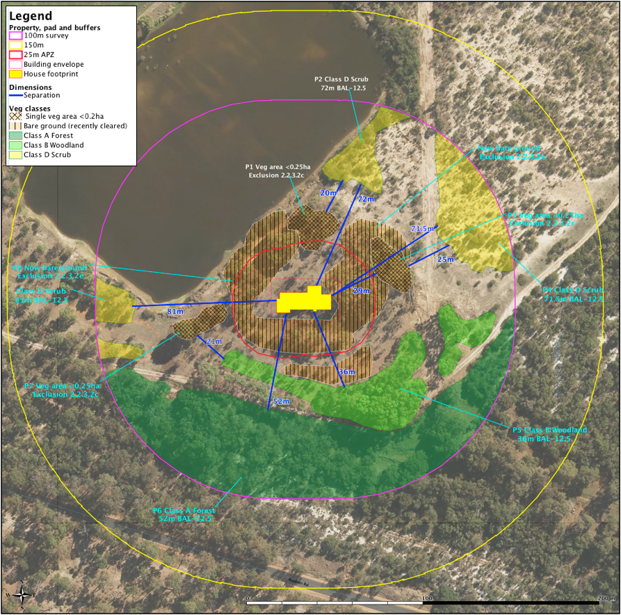
BAL ratings are based on vegetation classification, an assessment of effective slopes and the likely separation distances between the proposed habitable building and the various vegetation plots. Buildings will not gain approval where BAL ratings are above BAL-29.

Vegetation Classification
Vegetation assessment and classification including slope analysis as per AS3959. Incorporating building envelopes and clearing restrictions as required.
Environmental Issues
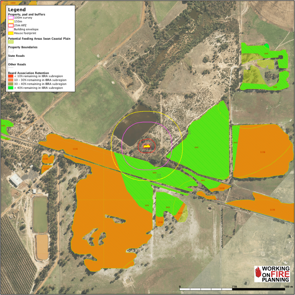
A vital part of bushfire planning and design is responding to policy requirements for biodiversity conservation such as, matters of national biodiversity significance, local declared, rare or threatened fauna and flora and threatened ecological communities.

Bushfire Management Plans (BMPs) specialising in subdivisions
We prepare Bushfire Management Plans led by our Level 2 practitioner, David Deeley, who is highly experienced in all subdivisional work from 2 lot to 20,000 lot developments.
Feel free to contact us for a discussion on what you might need. We know the constantly changing regulations and requirements can sometimes be challenging to understand and we are more than happy to help you get your head around them.
A BMP describes bushfire risks and the factors contributing to them, and various techniques for mitigating the determined risks. Implementation and compliance schedules identify those parties responsible for implementing the control measures as well as those responsible for auditing the actions.
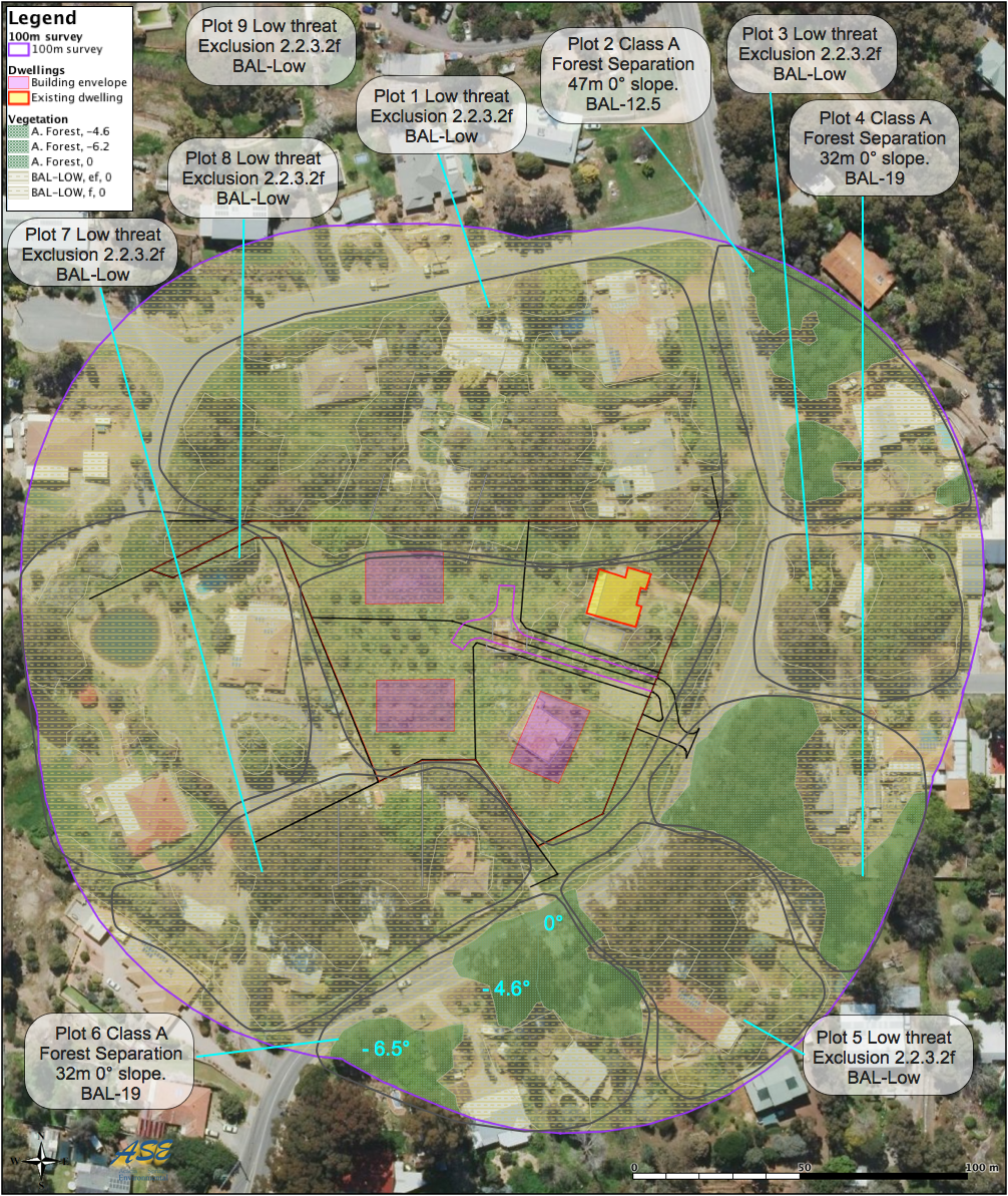
Vegetation classification
Vegetation assessment and classification including slope analysis as per AS3959. Vegetation needs to be classified as its probable mature status. Vegetation classification for BHL assessments (35 classes) is more detailed than that required for BAL contours (8 classes). This analysis needs to incorporate building envelopes and clearing restrictions as required.

Bushfire Hazard Level Assessment
BHL assessments are normally undertaken earlier in the planning cycle before lot layouts and suburb design have been finalised. This assessment identifies regional-scale bushfire risks and potential strategies to be considered during the process of land rezoning.

BAL Contours
BAL contours are normally prepared for areas already zoned for residential development eg. traditional small-lot urban development or certain special rural zones. BAL contours identify site-specific bushfire risks and the separation distances between vegetation plots and any proposed habitable buildings.
Ready to discuss or obtain a quote?

Bushfire Risk Management Plans
Preparing and auditing LGA risk management plans developed using the DFES Bushfire Risk Management Systems (BRMS) methodology.
BRMP INPUT: We have an experienced BRMP practitioner who has worked within local government preparing BRMPs for a large Perth-based local government. Field fuel load assessment, data gathering, mapping input and review services are available on a contract basis.
BRMP AUDIT: As part of due diligence, LGAs often require independent third-party auditing of their BRMPs. We have experience in whole of Shire level review of fuel loads in the field, risk assessment, classifications and prioritisation of mitigation actions, and in reviewing the range of treatment options being considered.
LGA executive teams benefit from the reassurance provided by these independent audits and as a result, are more likely to attract external funding and to support their staff recommended actions during review and decision making by elected Councillors.
Mapped Bushfire Risk
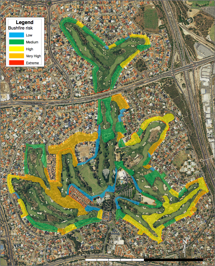
Joondalup International
Golf Course in Perth
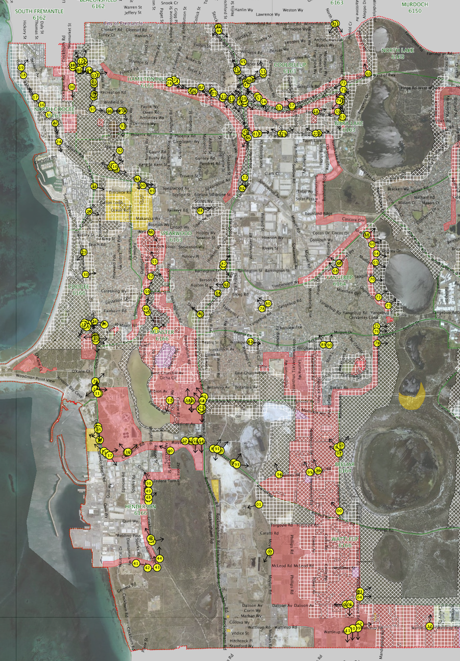
City of Cockburn

City of Armadale
These images show mapped bushfire risk. They include considerations of safety, critical infrastructure, built infrastructure and cultural and environmental heritage, vegetation type and fuel load, effective slope, separation distance, prevailing winds by season, fire run potential and fire containment potential.